


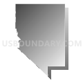
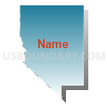
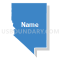
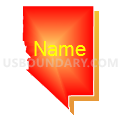
Rural Nevada PUMA, Nevada
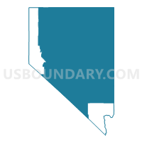
About
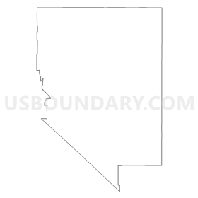
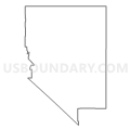
Outline
Summary
| Unique Area Identifier | 193353 |
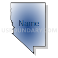
| Name | Rural Nevada PUMA |
| State | Nevada |
| Area (square miles) | 92,786.07 |
| Land Area (square miles) | 92,468.89 |
| Water Area (square miles) | 317.18 |
| % of Land Area | 99.66 |
| % of Water Area | 0.34 |
| Latitude of the Internal Point | 39.51092050 |
| Longtitude of the Internal Point | -116.47835100 |
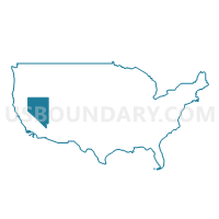
Maps
Graphs
Select a template below for downloading or customizing gragh for Rural Nevada PUMA, Nevada


Neighbors
Neighoring Public Use Microdata Area (by Name) Neighboring Public Use Microdata Area on the Map
- Alpine, Amador, Calaveras, Inyo, Mariposa, Mono & Tuolumne Counties PUMA, CA
- Canyon (South) & Owyhee Counties--Caldwell & Nampa (South & West) Cities PUMA, ID
- Carson City, Lyon, Douglas & Storey Counties PUMA, NV
- Clark County (East)--Mesquite City, Sunrise Manor (North), Moapa Valley & Nellis AFB PUMA, NV
- Clark County (North)--Las Vegas (Northeast) & North Las Vegas (Outer) Cities PUMA, NV
- Clark County (South)--Henderson (East) & Boulder Cities PUMA, NV
- Clark County (West)--Las Vegas City (Southwest) PUMA, NV
- Klamath, Malheur, Lake & Harney Counties PUMA, OR
- Mohave & La Paz Counties--Lake Havasu City PUMA, AZ
- Southwest & South Central Utah (Outside Washington County)--Cedar City PUMA, UT
- Tooele & Box Elder Counties PUMA, UT
- Twin Falls & Cassia Counties--Twin Falls City PUMA, ID
- Washington County--St. George City PUMA, UT
- Washoe County (North)--Sparks City PUMA, NV
Top 10 Neighboring County (by Population) Neighboring County on the Map
- Clark County, NV (1,951,269)
- Washoe County, NV (421,407)
- Mohave County, AZ (200,186)
- Washington County, UT (138,115)
- Twin Falls County, ID (77,230)
- Tooele County, UT (58,218)
- Lyon County, NV (51,980)
- Box Elder County, UT (49,975)
- Elko County, NV (48,818)
- Iron County, UT (46,163)
Top 10 Neighboring County Subdivision (by Population) Neighboring County Subdivision on the Map
- Clark CCD, Clark County, NV (179,324)
- St. George CCD, Washington County, UT (110,091)
- Elko CCD, Elko County, NV (36,944)
- Pahrump CCD, Nye County, NV (36,583)
- Fallon CCD, Churchill County, NV (24,678)
- Fernley CCD, Lyon County, NV (19,519)
- Winnemucca CCD, Humboldt County, NV (13,532)
- Mammoth Lakes CCD, Mono County, CA (12,117)
- North Mohave CCD, Mohave County, AZ (10,851)
- Yerington CCD, Lyon County, NV (7,886)
Top 10 Neighboring Place (by Population) Neighboring Place on the Map
- Pahrump CDP, NV (36,441)
- Fernley city, NV (19,368)
- Elko city, NV (18,297)
- Mesquite city, NV (15,276)
- Spring Creek CDP, NV (12,361)
- Fallon city, NV (8,606)
- Winnemucca city, NV (7,396)
- Silver Springs CDP, NV (5,296)
- West Wendover city, NV (4,410)
- Ely city, NV (4,255)
Top 10 Neighboring Elementary School District (by Population) Neighboring Elementary School District on the Map
- Bishop Union Elementary School District, CA (11,908)
- South Harney School District 33, OR (165)
- Frenchglen School District 16, OR (82)
Top 10 Neighboring Secondary School District (by Population) Neighboring Secondary School District on the Map
- Bishop Joint Union High School District, CA (12,976)
- Harney County Union High School District 1J, OR (1,429)
Top 10 Neighboring Unified School District (by Population) Neighboring Unified School District on the Map
- Clark County School District, NV (1,951,269)
- Washoe County School District, NV (421,407)
- Washington School District, UT (138,115)
- Tooele School District, UT (58,218)
- Lyon County School District, NV (51,980)
- Box Elder School District, UT (49,975)
- Elko County School District, NV (48,818)
- Iron School District, UT (46,163)
- Nye County School District, NV (43,946)
- Churchill County School District, NV (24,877)
Top 10 Neighboring State Legislative District Lower Chamber (by Population) Neighboring State Legislative District Lower Chamber on the Map
- Assembly District 34, CA (487,193)
- Assembly District 25, CA (475,252)
- Assembly District 13, NV (256,407)
- State House District 3, AZ (216,687)
- Assembly District 17, NV (96,848)
- Assembly District 32, NV (80,177)
- Assembly District 38, NV (66,836)
- Assembly District 36, NV (59,012)
- Assembly District 20, NV (58,569)
- State House District 60, OR (55,458)
Top 10 Neighboring State Legislative District Upper Chamber (by Population) Neighboring State Legislative District Upper Chamber on the Map
- State Senate District 18, CA (1,048,811)
- State Senate District 1, CA (1,002,597)
- Clark County Senatorial District 9, NV (354,064)
- State Senate District 3, AZ (216,687)
- Washoe County Senatorial District 2, NV (136,694)
- State Senate District 29, UT (120,802)
- State Senate District 30, OR (115,913)
- Central Nevada Senatorial District, NV (113,138)
- State Senate District 17, UT (102,922)
- Capital Senatorial District, NV (102,155)
Top 10 Neighboring 111th Congressional District (by Population) Neighboring 111th Congressional District on the Map
- Congressional District 3, NV (1,043,855)
- Congressional District 2, AZ (972,839)
- Congressional District 3, UT (966,232)
- Congressional District 1, UT (906,660)
- Congressional District 2, UT (890,993)
- Congressional District 25, CA (844,320)
- Congressional District 1, ID (841,930)
- Congressional District 2, NV (836,562)
- Congressional District 2, OR (769,987)
- Congressional District 2, ID (725,652)
Top 10 Neighboring Census Tract (by Population) Neighboring Census Tract on the Map
- Census Tract 9501, Mohave County, AZ (10,851)
- Census Tract 9601.01, Lyon County, NV (10,653)
- Census Tract 9604.06, Nye County, NV (8,377)
- Census Tract 2703, Washington County, UT (8,148)
- Census Tract 9604.04, Nye County, NV (7,522)
- Census Tract 9601, Pershing County, NV (6,753)
- Census Tract 75, Clark County, NV (6,314)
- Census Tract 9604.01, Nye County, NV (6,158)
- Census Tract 58.27, Clark County, NV (6,125)
- Census Tract 105, Humboldt County, NV (6,116)
Top 10 Neighboring 5-Digit ZIP Code Tabulation Area (by Population) Neighboring 5-Digit ZIP Code Tabulation Area on the Map
- 89406, NV (24,772)
- 89801, NV (23,298)
- 89048, NV (21,169)
- 89408, NV (19,626)
- 89445, NV (16,114)
- 89027, NV (15,275)
- 93514, CA (13,857)
- 89815, NV (13,346)
- 89060, NV (10,227)
- 89447, NV (7,931)